What value drones bring to construction industries over traditional methods
TAS Mapper Series UAS can be used to perform an aerial topographical survey, measurements, feasibility studies on construction site.
Objectives
1. To perform a topographical land survey of renovation school construction site.
2. Evaluation of Digital Elevation Model
3. Extraction of features like access road, back road and open area etc.
Deliverables
1. High resolution orthomosaic image and DEM
2. Point cloud data in LAS format
3. Stockpile volume calculations
4. Detail topographic survey in AutoCad/ArcGIS format
5. Detail contour model in dbf formats
6. 3D Model in Illustrator pdf formats
1. Topographic land survey of a construction site


2.Processed Image and Comparisons


3. Parameter Measurements
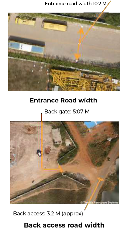
With the help of processed data, we measured the width of the access road and the back road.

4. Area and Distance Measurement of the constructed building
Using processed data, we measured the dimensions and calculated the area of the constructed building and also measured the volume of pit.
4.1 Area and length measurement

4.2 Construction area pit volumetric measurement

5. Creating Orthomosaic image and Digital Elevation Model
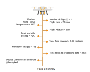
We created an orthomosaic image and a DEM with the help of Geotagged images. This helped us to visualize in detail, the mapped area.

6. Relative Accuracy

7. Obtain 3D Image

8. Results
1. Faster Turn around
2. Increased accuracies
3. Increased safety.
